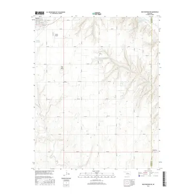
2016 Map of Weatherford NW
USGS Topo · Published 2016About this map
Thomas serves as the primary municipal anchor in this western Oklahoma survey, situated at the boundary of Custer and Blaine Counties. The landscape is defined by the sweeping course of the Canadian River in the northeast corner and a series of smaller drainage systems including Bear Cr, Little Deer Cr, and Deer Cr. A notable geological feature is Sugar Loaf Mound, which rises prominently above the surrounding agricultural sections.
Find a feature on this map
29 named features on this map. Tap any name to fly to it.
Don’t see what you’re looking for? This feature index may not catch every label — zoom into the map to look around manually.
Map Details
Editions of this 2016 Weatherford NW Map
This is the sole edition of this map. No revisions or reprints were ever made.
Other maps of this area

1955 · Clinton
USGS Topo · 1:250,000

1957 · Clinton
USGS Topo · 1:250,000

1957 · Clinton
USGS Topo · 1:62,500

1962 · Putnam
USGS Topo · 1:62,500

1964 · Oakwood
USGS Topo · 1:62,500

1964 · Weatherford
USGS Topo · 1:62,500

1976 · Clinton SE
USGS Topo · 1:24,000

1976 · Clinton NE
USGS Topo · 1:24,000
1983 · Indianapolis
USGS Topo · 1:24,000
1983 · Clinton NE
USGS Topo · 1:24,000