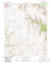
1985 Map of Weatherford NW
USGS Topo · Published 1985About this map
The town of Thomas anchors the northern portion of this map, situated at the crossroads of the Northern and Burlington rail lines. The landscape is defined by the sweeping course of the Canadian River in the northeast and the extensive reach of the Deer Creek Oil Field across the central plains. This 1985 revision provides a detailed view of mid-century infrastructure and land use, showing the proliferation of Gas Wells and Oil Wells alongside traditional rural community markers. Landmarks like Sugar Loaf Mound rise above the drainage systems of Deer Creek and Cedar Creek, while rural social history is preserved through scattered sites such as Jefferson Sch, St Johns Cem, and Zion Ch. The map illustrates the persistent energy economy of Custer County, punctuated by facilities like the Refinery and Thomas Municipal Airport.
Find a feature on this map
27 named features on this map. Tap any name to fly to it.
Don’t see what you’re looking for? This feature index may not catch every label — zoom into the map to look around manually.
Map Details
Editions of this 1985 Weatherford NW Map
This is the sole edition of this map. No revisions or reprints were ever made.
Other maps of this area

1955 · Clinton
USGS Topo · 1:250,000

1957 · Clinton
USGS Topo · 1:250,000

1957 · Clinton
USGS Topo · 1:62,500

1962 · Putnam
USGS Topo · 1:62,500

1964 · Oakwood
USGS Topo · 1:62,500

1964 · Weatherford
USGS Topo · 1:62,500

1976 · Clinton SE
USGS Topo · 1:24,000

1976 · Clinton NE
USGS Topo · 1:24,000
1983 · Indianapolis
USGS Topo · 1:24,000
1983 · Clinton NE
USGS Topo · 1:24,000