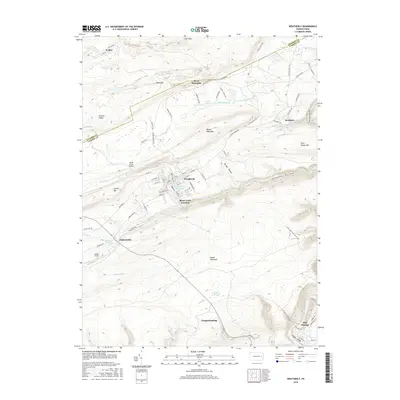
2016 Map of Weatherly
USGS Topo · Published 2016About this map
Weatherly sits at the heart of this Carbon County landscape, where the confluence of Koons Cr and Black Creek shaped the early development of this borough. The topography is defined by the massive ridges of Broad Mountain and Spring Mtn, which frame the narrow valleys that served as vital corridors for transportation. The map reveals a cluster of settlements including Hudsondale, Rockport, and the rail-oriented Black Creek Junction. To the south, the terrain drops toward Jim Thorpe and the Lehigh River, following the dramatic contours of the Lehigh Gorge. This survey details the complex network of roads and early trails, such as Stage Coach Rd and Buck Mountain Rd, that connected these coal-region communities and industrial sites like the patch town of Eckley in the north.
Find a feature on this map
90 named features on this map. Tap any name to fly to it.
Don’t see what you’re looking for? This feature index may not catch every label — zoom into the map to look around manually.
Map Details
Editions of this 2016 Weatherly Map
This is the sole edition of this map. No revisions or reprints were ever made.
Other maps of this area

1889 · Hazleton
USGS Topo · 1:62,500

1891 · Wilkesbarre
USGS Topo · 1:62,500

1891 · Hazleton
USGS Topo · 1:62,500

1893 · Hazleton
USGS Topo · 1:62,500

1894 · Wilkesbarre
USGS Topo · 1:62,500

1922 · Mauch Chunk
USGS Topo · 1:62,500

1922 · Stoddartsville
USGS Topo · 1:62,500

1924 · Stoddartsville
USGS Topo · 1:62,500

1924 · Mauch Chunk
USGS Topo · 1:62,500

1943 · Scranton
USGS Topo · 1:125,000