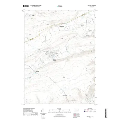
2019 Map of Weatherly
USGS Topo · Published 2019About this map
Weatherly sits at the center of this landscape, where the confluence of Koons Cr and Beaver Cr gives way to the broader Black Creek drainage. The map reveals a region defined by its industrial and social infrastructure, from the rail heritage of Black Creek Junction to the local recreation at Eurana Park Pool. Further north, the settlement of Eckley remains distinct near the Luzerne Co and Carbon Co line, while the terrain rises sharply toward Broad Mountain and Buck Mountain.
Find a feature on this map
100 named features on this map. Tap any name to fly to it.
Don’t see what you’re looking for? This feature index may not catch every label — zoom into the map to look around manually.
Map Details
Editions of this 2019 Weatherly Map
This is the sole edition of this map. No revisions or reprints were ever made.
Other maps of this area

1889 · Hazleton
USGS Topo · 1:62,500

1891 · Wilkesbarre
USGS Topo · 1:62,500

1891 · Hazleton
USGS Topo · 1:62,500

1893 · Hazleton
USGS Topo · 1:62,500

1894 · Wilkesbarre
USGS Topo · 1:62,500

1922 · Mauch Chunk
USGS Topo · 1:62,500

1922 · Stoddartsville
USGS Topo · 1:62,500

1924 · Stoddartsville
USGS Topo · 1:62,500

1924 · Mauch Chunk
USGS Topo · 1:62,500

1943 · Scranton
USGS Topo · 1:125,000