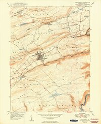
1950 Map of Weatherly
USGS Topo · Published 1950About this map
Weatherly sits at the heart of this post-war landscape, where the anthracite coal industry and complex rail networks converge along Black Creek and the Lehigh River. Significant Strip Mine operations dominate the northern reaches of the map, particularly near the settlement of Eckley and the ridges of Buck Mountain. These excavations, mapped from 1942 aerial photography, illustrate the intensive industrial footprint on the Carbon County terrain.
Find a feature on this map
44 named features on this map. Tap any name to fly to it.
Don’t see what you’re looking for? This feature index may not catch every label — zoom into the map to look around manually.
Map Details
Editions of this 1950 Weatherly Map
2 editions found
Other maps of this area

1889 · Hazleton
USGS Topo · 1:62,500

1891 · Wilkesbarre
USGS Topo · 1:62,500

1891 · Hazleton
USGS Topo · 1:62,500

1893 · Hazleton
USGS Topo · 1:62,500

1894 · Wilkesbarre
USGS Topo · 1:62,500

1922 · Mauch Chunk
USGS Topo · 1:62,500

1922 · Stoddartsville
USGS Topo · 1:62,500

1924 · Stoddartsville
USGS Topo · 1:62,500

1924 · Mauch Chunk
USGS Topo · 1:62,500

1943 · Scranton
USGS Topo · 1:125,000