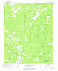
1973 Map of Weathers
USGS Topo · Published 1976About this map
Venus and Weathers serve as the primary residential nodes in this 1970s topographic record of the Madison and Newton County border. The landscape is defined by the winding course of the Kings River, which is fed by numerous drainages including Henderson Creek, Felkins Creek, and Marksburg Creek. This area of the Ozark National Forest is notable for its high concentration of family and community burial grounds, such as Mt Olive Cem and Eagle Gap Cem, which provide significant data points for genealogical research in this part of Arkansas. The terrain is marked by prominent high points including Venus Mountain and Penitentiary Mountain, while local spiritual life is anchored by Venus Ch. A network of hollows, such as Whispering Hollow and Cowcumber Hollow, illustrates the traditional settlement patterns along the valley floors and narrow ridges.
Find a feature on this map
39 named features on this map. Tap any name to fly to it.
Don’t see what you’re looking for? This feature index may not catch every label — zoom into the map to look around manually.
Map Details
Editions of this 1973 Weathers Map
2 editions found
Other maps of this area

1900 · Eureka Springs
USGS Topo · 1:125,000

1901 · Eureka Springs
USGS Topo · 1:125,000

1904 · Harrison
USGS Topo · 1:125,000

1905 · Harrison
USGS Topo · 1:125,000

1945 · Harrison
USGS Topo · 1:250,000

1949 · Harrison
USGS Topo · 1:250,000

1954 · Harrison
USGS Topo · 1:250,000

1956 · Russellville
USGS Topo · 1:250,000

1958 · Harrison
USGS Topo · 1:250,000

1964 · Russellville
USGS Topo · 1:250,000