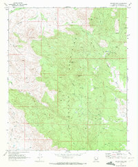
1969 Map of Weaver Peak
USGS Topo · Published 1972About this map
Weaver Mountains define this landscape in Yavapai County, characterized by high elevations and a network of mining activity. In the late 1960s, the terrain was accessed primarily by a primitive Jeep Trail system, connecting localized extraction sites like the Monte Cristo Mine, Buckhorn Mine, and Cuba Mine. These operations were situated near prominent landmarks such as Weaver Peak and Rocky Boy Peak, where seasonal springs provided essential water sources in the arid environment.
Find a feature on this map
17 named features on this map. Tap any name to fly to it.
Don’t see what you’re looking for? This feature index may not catch every label — zoom into the map to look around manually.
Map Details
Editions of this 1969 Weaver Peak Map
2 editions found
Other maps of this area

1887 · Prescott
USGS Topo · 1:250,000

1892 · Prescott
USGS Topo · 1:250,000

1903 · Congress
USGS Topo · 1:125,000

1904 · Congress
USGS Topo · 1:125,000

1947 · Kirkland
USGS Topo · 1:62,500

1947 · Wagoner
USGS Topo · 1:62,500

1948 · Kirkland
USGS Topo · 1:63,360

1948 · Wagoner
USGS Topo · 1:63,360

1950 · Wagoner
USGS Topo · 1:62,500
1950 · Kirkland
USGS Topo · 1:62,500