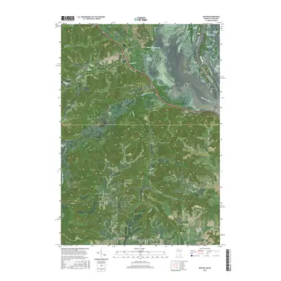
2016 Map of Weaver
USGS Topo · Published 2016About this map
The Mississippi River corridor dominates this landscape at the border of Minnesota and Wisconsin, where the broad expanse of the Weaver Bottoms meets a complex network of backwaters and islands. The settlement of Weaver sits at the junction where the Whitewater River flows into this vast wetland complex, framed by high bluffs including Rattlesnake Ridge and Hoosier Ridge. Further south, the town of Minneiska is perched along the riverbank, surrounded by a high density of local burial grounds such as Saint Marys Cem, Hillside Cem, and Evergreen Cem.
Find a feature on this map
91 named features on this map. Tap any name to fly to it.
Don’t see what you’re looking for? This feature index may not catch every label — zoom into the map to look around manually.
Map Details
Editions of this 2016 Weaver Map
This is the sole edition of this map. No revisions or reprints were ever made.
Other maps of this area

1932 · Cochrane
USGS Topo · 1:62,500

1932 · Wabasha
USGS Topo · 1:62,500

1932 · Alma
USGS Topo · 1:62,500

1934 · Plainview
USGS Topo · 1:62,500

1934 · Cochrane
USGS Topo · 1:62,500

1937 · Cochrane
USGS Topo · 1:62,500

1938 · Plainview
USGS Topo · 1:62,500

1950 · Alma
USGS Topo · 1:62,500

1951 · Wabasha
USGS Topo · 1:62,500

1953 · Saint Paul
USGS Topo · 1:250,000