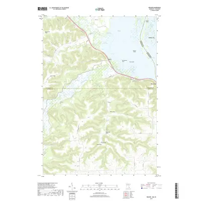
2019 Map of Weaver
USGS Topo · Published 2019About this map
Buffalo City and the riverfront communities of Weaver and Minneiska anchor this survey of the Upper Mississippi River valley at the border of Minnesota and Wisconsin. The landscape is defined by the complex aquatic geography of the Mississippi River, where Weaver Bottoms and numerous sloughs like Krueger Slough and Belvidere Slough create a labyrinth of islands including Muench Island and Swan Island. This intricate wetland system contrasts sharply with the high bluffs to the west, where family-named landmarks like Hidershide Valley, Frisch Valley, and Selke Valley suggest a long history of local settlement and land use. Genealogists can identify several distinct burial sites across the terrain, from Saint Marys Cem and Hillside Cem near the river to the more isolated Young Cem in the uplands. The drainage patterns of the Whitewater River and Trout Cr further illustrate the topographic transition from the river's edge to the prominent heights of Rattlesnake Ridge and Hoosier Ridge.
Find a feature on this map
60 named features on this map. Tap any name to fly to it.
Don’t see what you’re looking for? This feature index may not catch every label — zoom into the map to look around manually.
Map Details
Editions of this 2019 Weaver Map
This is the sole edition of this map. No revisions or reprints were ever made.
Other maps of this area

1932 · Cochrane
USGS Topo · 1:62,500

1932 · Wabasha
USGS Topo · 1:62,500

1932 · Alma
USGS Topo · 1:62,500

1934 · Plainview
USGS Topo · 1:62,500

1934 · Cochrane
USGS Topo · 1:62,500

1937 · Cochrane
USGS Topo · 1:62,500

1938 · Plainview
USGS Topo · 1:62,500

1950 · Alma
USGS Topo · 1:62,500

1951 · Wabasha
USGS Topo · 1:62,500

1953 · Saint Paul
USGS Topo · 1:250,000