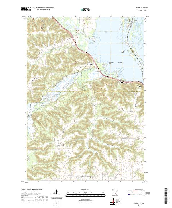
2022 Map of Weaver
USGS Topo · Published 2022About this map
The Mississippi River corridor dominates this survey, where the river's broad backwaters and sloughs define the eastern boundary between Minnesota and Wisconsin. The intricate wetlands of Weaver Bottoms and Krueger Slough separate the main channel from the mainland, punctuated by landforms like Mallard Island and Swan Island. Along the western bluffs, the terrain rises sharply into Rattlesnake Ridge and Hoosier Ridge, creating a dramatic transition from the river valley to high agricultural plateaus.
Find a feature on this map
65 named features on this map. Tap any name to fly to it.
Don’t see what you’re looking for? This feature index may not catch every label — zoom into the map to look around manually.
Map Details
Editions of this 2022 Weaver Map
This is the sole edition of this map. No revisions or reprints were ever made.
Other maps of this area

1932 · Cochrane
USGS Topo · 1:62,500

1932 · Wabasha
USGS Topo · 1:62,500

1932 · Alma
USGS Topo · 1:62,500

1934 · Plainview
USGS Topo · 1:62,500

1934 · Cochrane
USGS Topo · 1:62,500

1937 · Cochrane
USGS Topo · 1:62,500

1938 · Plainview
USGS Topo · 1:62,500

1950 · Alma
USGS Topo · 1:62,500

1951 · Wabasha
USGS Topo · 1:62,500

1953 · Saint Paul
USGS Topo · 1:250,000