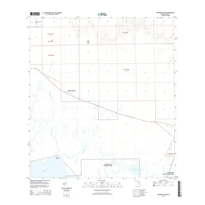
2015 Map of Weavers Station
USGS Topo · Published 2015About this map
Weavers Station serves as a lone landmark along the historic transit corridor of the Tamiami Canal Number C-4 in this southern Florida landscape. The area is defined by the transition from terrestrial environments like Dan House Prairie and Four Stake Prairie in the north to the sprawling wetlands of the Everglades National Park and Big Cypress National Preserve in the south. This coastal interface is marked by a complex network of waterways including the Fakahatchee River and Ferguson River, which eventually open into Fakahatchee Bay and Ferguson Bay. The map provides a detailed view of the remote terrain where local landmarks like Daniels Point stand out against the vast marshlands, illustrating the region's preservation of wilderness and its limited infrastructure, represented here primarily by CR 29 and the northern residential grid near Merritt Blvd.
Find a feature on this map
20 named features on this map. Tap any name to fly to it.
Don’t see what you’re looking for? This feature index may not catch every label — zoom into the map to look around manually.
Map Details
Editions of this 2015 Weavers Station Map
This is the sole edition of this map. No revisions or reprints were ever made.
Other maps of this area

1956 · Miami
USGS Topo · 1:250,000

1956 · West Palm Beach
USGS Topo · 1:250,000

1957 · West Palm Beach
USGS Topo · 1:250,000

1958 · West Palm Beach
USGS Topo · 1:250,000

1958 · Miami
USGS Topo · 1:250,000

1958 · Belle Meade SE
USGS Topo · 1:24,000

1959 · Deep Lake
USGS Topo · 1:24,000

1959 · Deep Lake SW
USGS Topo · 1:24,000

1972 · Weavers Station
USGS Topo · 1:24,000

1972 · Ochopee
USGS Topo · 1:24,000