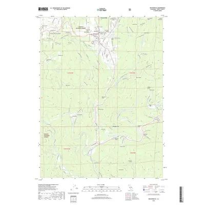
2018 Map of Weaverville
USGS Topo · Published 2018About this map
Weaverville and its surrounding mountain terrain serve as the centerpiece of this Trinity County landscape, showing the town's position at the foot of the Salmon Mountains. The 2018 survey detail provides a look at local landmarks such as the Weaverville Cem and the Lonnie Pool Field/Weaverville Airport, reflecting a community that has preserved its historical footprint even as modern infrastructure evolved. To the south, Douglas City sits near the confluence where Reading Cr and Browns Cr meet the winding Trinity River. This area is characterized by a high concentration of gold-rush era naming conventions, with numerous gulches like Ten Cent Gulch, Five Cent Gulch, and China Gulch carving through the slopes. The map traces a complex network of logging and forest roads, including the Oregon Mountain Rd and Democrat Gulch Rd, that navigate the heights of the Trinity National Forest.
Find a feature on this map
153 named features on this map. Tap any name to fly to it.
Don’t see what you’re looking for? This feature index may not catch every label — zoom into the map to look around manually.
Map Details
Editions of this 2018 Weaverville Map
This is the sole edition of this map. No revisions or reprints were ever made.
Other maps of this area

1890 · Red Bluff
USGS Topo · 1:250,000

1894 · Red Bluff
USGS Topo · 1:250,000

1909 · Big Bar
USGS Topo · 1:96,000

1913 · Weaverville
USGS Topo · 1:125,000

1915 · Big Bar and Vicinity
USGS Topo · 1:250,000

1950 · Minersville
USGS Topo · 1:62,500

1950 · Weaverville
USGS Topo · 1:62,500

1951 · Hayfork
USGS Topo · 1:62,500

1951 · Helena
USGS Topo · 1:62,500

1952 · Weaverville
USGS Topo · 1:62,500