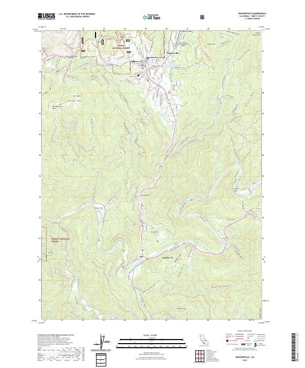
2022 Map of Weaverville
USGS Topo · Published 2022About this map
The Trinity County Courthouse stands as a central landmark in Weaverville, the historic seat of Trinity County, surrounded by the densely wooded terrain of the Trinity National Forest. This modern 2022 survey captures the community’s layout, from the residential streets like Masonic Lane and Odd Fellows Avenue to the local Weaverville Cemetery. The landscape is defined by its gold-rush legacy, evidenced by numerous named gulches and flats such as Oregon Gulch, Sweepstake Flat, and Poison Gulch. To the south, the Trinity Wild and Scenic River winds past Douglas City, while the Lonnie Pool Field/Weaverville Airport serves as a modern aviation link. Smaller settlements like Steiner Flat and the community at Poker Bar are also detailed, showing the persistent residential patterns along the river and the base of Oregon Mountain.
Find a feature on this map
116 named features on this map. Tap any name to fly to it.
Don’t see what you’re looking for? This feature index may not catch every label — zoom into the map to look around manually.
Map Details
Editions of this 2022 Weaverville Map
This is the sole edition of this map. No revisions or reprints were ever made.
Other maps of this area

1890 · Red Bluff
USGS Topo · 1:250,000

1894 · Red Bluff
USGS Topo · 1:250,000

1909 · Big Bar
USGS Topo · 1:96,000

1913 · Weaverville
USGS Topo · 1:125,000

1915 · Big Bar and Vicinity
USGS Topo · 1:250,000

1950 · Minersville
USGS Topo · 1:62,500

1950 · Weaverville
USGS Topo · 1:62,500

1951 · Hayfork
USGS Topo · 1:62,500

1951 · Helena
USGS Topo · 1:62,500

1952 · Weaverville
USGS Topo · 1:62,500