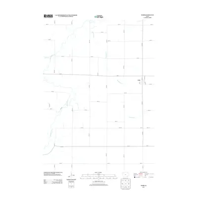
2013 Map of Webb
USGS Topo · Published 2013About this map
Webb sits at the eastern edge of this Clay County landscape, where the town's small grid is defined by Lake St and Church St. The surrounding terrain is dominated by a systematic agricultural grid of numbered avenues and streets, a hallmark of the midwestern prairie. This geometric order is broken only by the meandering paths of the Little Sioux River and its tributaries, Montgomery Cr and Willow Cr. The drainage patterns of these waterways create the only significant relief in an otherwise strictly partitioned territory. This survey documents the modern rural infrastructure along the Co Line Rd, reflecting the enduring township-and-range division of Iowa's farmland in the early twenty-first century.
Find a feature on this map
37 named features on this map. Tap any name to fly to it.
Don’t see what you’re looking for? This feature index may not catch every label — zoom into the map to look around manually.
Map Details
Editions of this 2013 Webb Map
This is the sole edition of this map. No revisions or reprints were ever made.
Other maps of this area

1954 · Fairmont
USGS Topo · 1:250,000

1954 · Fort Dodge
USGS Topo · 1:250,000

1957 · Fort Dodge
USGS Topo · 1:250,000

1958 · Fort Dodge
USGS Topo · 1:250,000

1958 · Fairmont
USGS Topo · 1:250,000

1966 · Gillett Grove
USGS Topo · 1:24,000

1966 · Greenville
USGS Topo · 1:24,000

1971 · Sioux Rapids SE
USGS Topo · 1:24,000

1971 · Albert City
USGS Topo · 1:24,000

1971 · Rembrandt
USGS Topo · 1:24,000