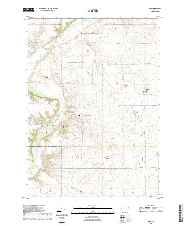
2022 Map of Webb
USGS Topo · Published 2022About this map
Webb serves as the primary hub of this agricultural landscape in northwestern Iowa, situated near the intersection of Co Hwy M54 and 5th Ave. The terrain is defined by the winding course of the Little Sioux River, which meanders through the western half of the map, joined by tributaries such as Willow Cr and Montgomery Cr. This drainage system created the gently undulating prairie that characterizes the border region between Clay and Buena Vista counties.
Find a feature on this map
30 named features on this map. Tap any name to fly to it.
Don’t see what you’re looking for? This feature index may not catch every label — zoom into the map to look around manually.
Map Details
Editions of this 2022 Webb Map
This is the sole edition of this map. No revisions or reprints were ever made.
Other maps of this area

1954 · Fairmont
USGS Topo · 1:250,000

1954 · Fort Dodge
USGS Topo · 1:250,000

1957 · Fort Dodge
USGS Topo · 1:250,000

1958 · Fort Dodge
USGS Topo · 1:250,000

1958 · Fairmont
USGS Topo · 1:250,000

1966 · Gillett Grove
USGS Topo · 1:24,000

1966 · Greenville
USGS Topo · 1:24,000

1971 · Sioux Rapids SE
USGS Topo · 1:24,000

1971 · Albert City
USGS Topo · 1:24,000

1971 · Rembrandt
USGS Topo · 1:24,000