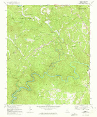
1971 Map of Webb
USGS Topo · Published 1973About this map
The Coosawattee River snakes through this North Georgia landscape, captured during a period of transition as the basin began to fill following the creation of Carters Lake. This survey reveals a community anchored by rural congregations such as New Hope Ch, Tails Creek Ch, and Pleasant Grove Ch, reflecting the deep-rooted social geography of Gilmer County. Significant terrain features like Pleasant Gap and the dense canopy of the Chattahoochee National Forest dominate the northern half of the sheet. Small settlements like Ollie, Elders, and Roosevelt are shown alongside local infrastructure including the County Airport and a prominent Lookout Tower. The map provides a look at the winding river valley just before much of the shoreline was permanently altered, making it a valuable tool for tracing family land and vanished creek-side crossings.
Find a feature on this map
36 named features on this map. Tap any name to fly to it.
Don’t see what you’re looking for? This feature index may not catch every label — zoom into the map to look around manually.
Map Details
Editions of this 1971 Webb Map
2 editions found
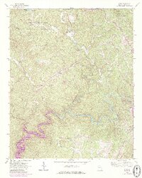
Other maps of this area

1886 · Dalton
USGS Topo · 1:125,000

1888 · Ellijay
USGS Topo · 1:125,000

1892 · Ellijay
USGS Topo · 1:125,000

1892 · Dalton
USGS Topo · 1:125,000

1897 · Dalton
USGS Topo · 1:125,000

1898 · Ellijay
USGS Topo · 1:125,000

1911 · Ellijay
USGS Topo · 1:125,000

1911 · Cohutta Mtn
USGS Topo · 1:62,500

1913 · Cohutta Mtn.
USGS Topo · 1:62,500

1914 · Talking Rock
USGS Topo · 1:62,500