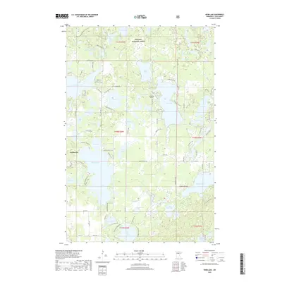
2019 Map of Webb Lake
USGS Topo · Published 2019About this map
Hackensack serves as the primary settlement on this landscape, positioned on the western edge of Pleasant Lake. The area is defined by an intricate network of glacial lakes and wetlands characteristic of the Chippewa National Forest. Major water bodies such as Webb Lake, Big Deep Lake, and Little Boy Lake are interconnected by the Boy River, illustrating the historical and ecological importance of these northern Minnesota waterways.
Find a feature on this map
103 named features on this map. Tap any name to fly to it.
Don’t see what you’re looking for? This feature index may not catch every label — zoom into the map to look around manually.
Map Details
Editions of this 2019 Webb Lake Map
This is the sole edition of this map. No revisions or reprints were ever made.
Other maps of this area

1953 · Brainerd
USGS Topo · 1:250,000

1954 · Bemidji
USGS Topo · 1:250,000

1957 · Brainerd
USGS Topo · 1:250,000

1957 · Bemidji
USGS Topo · 1:250,000

1958 · Bemidji
USGS Topo · 1:250,000

1958 · Brainerd
USGS Topo · 1:250,000

1965 · Brainerd
USGS Topo · 1:250,000

1970 · Backus
USGS Topo · 1:24,000

1970 · Hackensack
USGS Topo · 1:24,000
1970 · Mildred
USGS Topo · 1:24,000