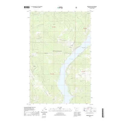
2020 Map of Webb Mountain
USGS Topo · Published 2020About this map
Kootenai National Forest dominates this section of Lincoln County, where the steep terrain of the Purcell Mountains meets the waters of Lake Koocanusa. The map reveals a landscape defined by significant elevation changes, from the prominent summit of Webb Mtn to the shoreline at Cliff Point. This modern survey illustrates the current footprint of the reservoir, created by damming the Kootenai River, and shows how the Koocanusa Bridge serves as a vital crossing point in this wilderness area.
Find a feature on this map
35 named features on this map. Tap any name to fly to it.
Don’t see what you’re looking for? This feature index may not catch every label — zoom into the map to look around manually.
Map Details
Editions of this 2020 Webb Mountain Map
This is the sole edition of this map. No revisions or reprints were ever made.
Other maps of this area

1957 · Kalispell
USGS Topo · 1:250,000

1960 · Kalispell
USGS Topo · 1:250,000

1961 · Kalispell
USGS Topo · 1:250,000

1963 · Rexford
USGS Topo · 1:24,000

1963 · Robinson Mountain
USGS Topo · 1:24,000

1963 · Mc Guire Mountain
USGS Topo · 1:24,000

1963 · Red Mountain
USGS Topo · 1:24,000

1963 · Webb Mountain
USGS Topo · 1:24,000

1963 · Boulder Lakes
USGS Topo · 1:24,000
1963 · Inch Mountain
USGS Topo · 1:24,000