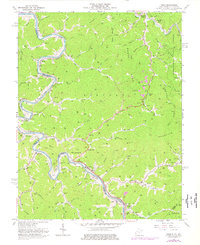
1963 Map of Webb
USGS Topo · Published 1976About this map
The Tug Fork carves a winding path along the West Virginia and Kentucky border, anchoring a landscape defined by the Norfolk and Western railway and a dense network of mountain hollows. The area is characterized by concentrated river-bottom settlements such as Crum and Webb, where the infrastructure of the valley meets the steep slopes of Bull Mountain and Wells Mountain. Numerous small family-named churches and schools, including Mothers United Ch and Big Elk Sch, are tucked into the drainages of Bull Creek and Jennie, reflecting the close-knit community structure of Wayne County in the mid-20th century.
Find a feature on this map
100 named features on this map. Tap any name to fly to it.
Don’t see what you’re looking for? This feature index may not catch every label — zoom into the map to look around manually.
Map Details
Editions of this 1963 Webb Map
4 editions found
Other maps of this area

1886 · Prestonsburg
USGS Topo · 1:125,000

1887 · Warfield
USGS Topo · 1:125,000

1891 · Warfield
USGS Topo · 1:125,000

1892 · Prestonsburg
USGS Topo · 1:125,000

1892 · Huntington
USGS Topo · 1:125,000

1898 · Huntington
USGS Topo · 1:125,000

1903 · Kenova
USGS Topo · 1:125,000

1904 · Kenova
USGS Topo · 1:125,000

1909 · Wayne
USGS Topo · 1:62,500

1910 · Naugatuck
USGS Topo · 1:48,000