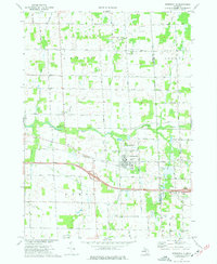
1973 Map of Webberville
USGS Topo · Published 1977About this map
The village of Webberville serves as the focal point of this Ingham County study, situated along the Chesapeake and Ohio railway and the historic Grand River Road. The landscape is a patchwork of agricultural fields and woodlots, drained by the Red Cedar River and its tributaries, including Wolf Creek and Squaw Creek. The presence of numerous small family and community cemeteries, such as Rowley Cem, Alchin Cem, and Coffey Cem, provides a detailed record of 19th-century settlement patterns across the townships of Locke, Conway, Leroy, and Handy.
Find a feature on this map
75 named features on this map. Tap any name to fly to it.
Don’t see what you’re looking for? This feature index may not catch every label — zoom into the map to look around manually.
Map Details
Editions of this 1973 Webberville Map
This is the sole edition of this map. No revisions or reprints were ever made.
Other maps of this area

1908 · Fowlerville
USGS Topo · 1:62,500

1909 · Mason
USGS Topo · 1:62,500

1910 · Fowlerville
USGS Topo · 1:62,500

1911 · Mason
USGS Topo · 1:62,500

1926 · Corunna
USGS Topo · 1:62,500

1928 · Laingsburg
USGS Topo · 1:62,500

1929 · Corunna
USGS Topo · 1:62,500

1944 · Laingsburg
USGS Topo · 1:62,500

1944 · Corunna
USGS Topo · 1:62,500

1958 · Grand Rapids
USGS Topo · 1:250,000