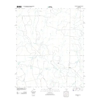
2012 Map of Webbville
USGS Topo · Published 2012About this map
Webbville serves as the quiet focal point of this rural Coleman County landscape, situated at the junction of several farm-to-market and county roads. The terrain is defined by a complex drainage network where Pecan Bayou and its many tributaries, including Little Pecan Bayou and Buffalo Br, wind through the plains. The influence of mid-century water management is evident in the presence of the Soil Conservation Service Site 19 Reservoir and Soil Conservation Service Site 20 Reservoir, which sit alongside established water bodies like Knox Lake Number 1. Genealogists and local historians will find the Adams Cem in the southeastern corner, a small but significant site for family research in this part of Texas. The landscape's varied character is further marked by the presence of Wolf Hollow, indicating the subtle but distinct breaks in the otherwise steady agricultural and ranching land.
Find a feature on this map
33 named features on this map. Tap any name to fly to it.
Don’t see what you’re looking for? This feature index may not catch every label — zoom into the map to look around manually.
Map Details
Editions of this 2012 Webbville Map
This is the sole edition of this map. No revisions or reprints were ever made.
Other maps of this area

1887 · Coleman
USGS Topo · 1:125,000

1889 · Coleman
USGS Topo · 1:125,000

1924 · Brownwood Reservoir Site
USGS Topo · 1:48,000

1927 · Grosvenor
USGS Topo · 1:62,500

1931 · Baird
USGS Topo · 1:125,000

1932 · Baird
USGS Topo · 1:125,000

1954 · Brownwood
USGS Topo · 1:250,000

1954 · Abilene
USGS Topo · 1:250,000

1958 · Abilene
USGS Topo · 1:250,000

1960 · Lake Scarborough
USGS Topo · 1:24,000