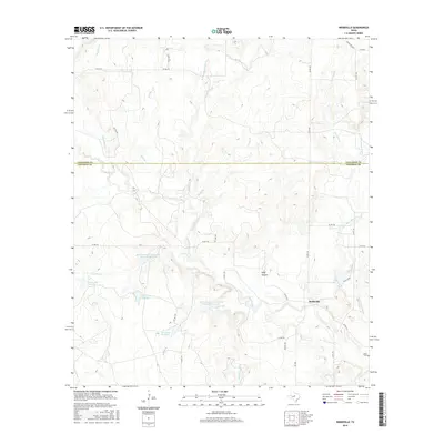
2016 Map of Webbville
USGS Topo · Published 2016About this map
The borderlands of Callahan Co and Coleman Co are defined by a sophisticated network of water management and drainage across the Texas landscape. Central to this system are the Knox Lake Number 1, Knox Lake Number 2, and Knox Lake Number 3 reservoirs, which sit alongside large-scale soil conservation efforts like the Soil Conservation Service Site 20 Reservoir. These man-made features interact with the natural courses of Pecan Bayou and Little Pecan Bayou, which snake through the territory toward the settlement of Webbville. The terrain is marked by distinctive local landmarks such as Wolf Hollow and numerous tributaries including Buffalo Br and Mesquite Br. In the southeast corner, the presence of Adams Cem near the junction of several county roads offers a tangible point of interest for those researching local family history and the rural distribution of early Texas settlements.
Find a feature on this map
38 named features on this map. Tap any name to fly to it.
Don’t see what you’re looking for? This feature index may not catch every label — zoom into the map to look around manually.
Map Details
Editions of this 2016 Webbville Map
This is the sole edition of this map. No revisions or reprints were ever made.
Other maps of this area

1887 · Coleman
USGS Topo · 1:125,000

1889 · Coleman
USGS Topo · 1:125,000

1924 · Brownwood Reservoir Site
USGS Topo · 1:48,000

1927 · Grosvenor
USGS Topo · 1:62,500

1931 · Baird
USGS Topo · 1:125,000

1932 · Baird
USGS Topo · 1:125,000

1954 · Brownwood
USGS Topo · 1:250,000

1954 · Abilene
USGS Topo · 1:250,000

1958 · Abilene
USGS Topo · 1:250,000

1960 · Lake Scarborough
USGS Topo · 1:24,000