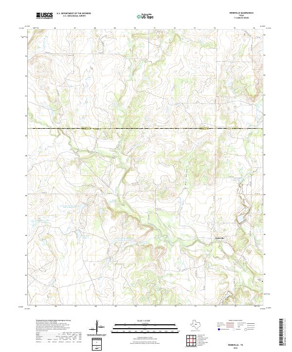
2022 Map of Webbville
USGS Topo · Published 2022About this map
Pecan Bayou and its numerous tributaries dominate this landscape along the boundary of Callahan and Coleman counties. The small settlement of Webbville serves as a central point in an area defined by ranching and water management, evidenced by the presence of the Soil Conservation Service Site 19 Reservoir and Site 20 Reservoir. These reservoirs, along with Knox Lake Number 1 and Knox Lake Number 2, reflect mid-to-late 20th-century efforts to control erosion and manage water resources in the rolling Texas terrain.
Find a feature on this map
36 named features on this map. Tap any name to fly to it.
Don’t see what you’re looking for? This feature index may not catch every label — zoom into the map to look around manually.
Map Details
Editions of this 2022 Webbville Map
This is the sole edition of this map. No revisions or reprints were ever made.
Other maps of this area

1887 · Coleman
USGS Topo · 1:125,000

1889 · Coleman
USGS Topo · 1:125,000

1924 · Brownwood Reservoir Site
USGS Topo · 1:48,000

1927 · Grosvenor
USGS Topo · 1:62,500

1931 · Baird
USGS Topo · 1:125,000

1932 · Baird
USGS Topo · 1:125,000

1954 · Brownwood
USGS Topo · 1:250,000

1954 · Abilene
USGS Topo · 1:250,000

1958 · Abilene
USGS Topo · 1:250,000

1960 · Lake Scarborough
USGS Topo · 1:24,000