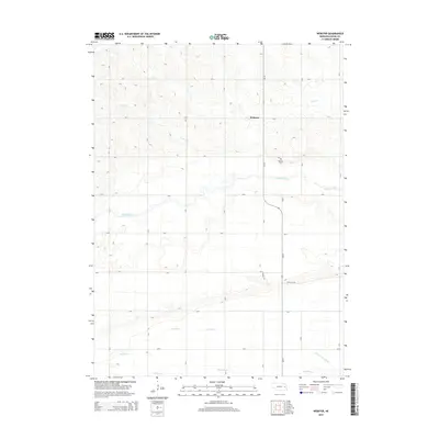
2014 Map of Webster
USGS Topo · Published 2014About this map
The small community of Webster serves as the focal point of this Dodge County landscape, situated along the north-south corridor of Ne-79. The area is defined by a dense network of sectional roads and the meandering paths of Silver Cr and Maple Creek, which cut through the agricultural plains. For those tracing local heritage, the Webster Cem is a primary landmark situated just south of the settlement. To the south, the terrain shifts into a complex system of water management and drainage, evidenced by features such as the Scott Ditch and the Central Cutoff Ditch near Rawhide Cr. This network illustrates the long-standing efforts to regulate the Platte River valley's watershed to support the region's intensive farming. The map also traces various country roads like CR-L and Foothill Rd, providing a detailed view of the rural infrastructure in the early 21st century.
Find a feature on this map
24 named features on this map. Tap any name to fly to it.
Don’t see what you’re looking for? This feature index may not catch every label — zoom into the map to look around manually.
Map Details
Editions of this 2014 Webster Map
This is the sole edition of this map. No revisions or reprints were ever made.
Other maps of this area

1899 · Wahoo
USGS Topo · 1:125,000

1955 · Fremont
USGS Topo · 1:250,000

1957 · Fremont
USGS Topo · 1:250,000

1958 · Fremont
USGS Topo · 1:250,000

1966 · Scribner SW
USGS Topo · 1:24,000

1966 · Webster
USGS Topo · 1:24,000

1966 · Snyder
USGS Topo · 1:24,000

1966 · Scribner
USGS Topo · 1:24,000

1966 · Dodge SW
USGS Topo · 1:24,000
1966 · Dodge
USGS Topo · 1:24,000