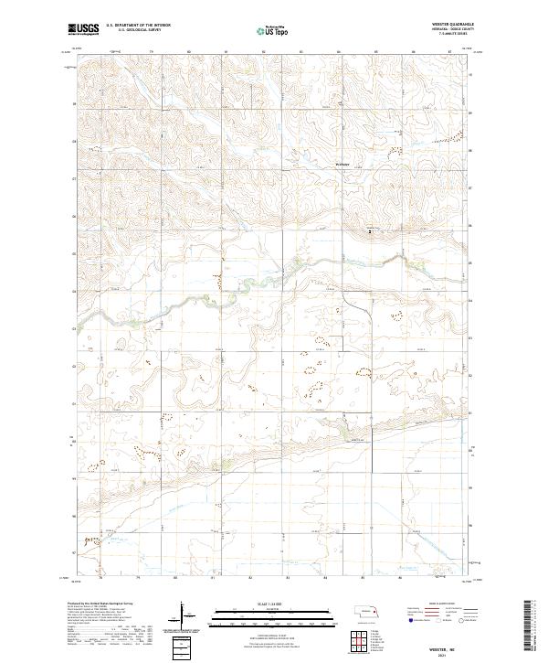
2021 Map of Webster
USGS Topo · Published 2021About this map
Webster stands as the central point of this agricultural landscape in Dodge County, situated among the undulating terrain between several prominent waterways. The area is defined by the drainage patterns of Silver Cr and Crystal Cr to the north, while Maple Creek meanders through the central sections. To the south, the map reveals a more managed water system where Scott Ditch and the Central Cutoff Ditch interface with Rawhide Cr. The rural road network is laid out in a strict grid, following township and range lines such as t19n r5e and t19n r6e, which anchor the local farmsteads. Local history is anchored at the Webster Cem, a key landmark for genealogical research in this part of Nebraska.
Find a feature on this map
32 named features on this map. Tap any name to fly to it.
Don’t see what you’re looking for? This feature index may not catch every label — zoom into the map to look around manually.
Map Details
Editions of this 2021 Webster Map
This is the sole edition of this map. No revisions or reprints were ever made.
Other maps of this area

1899 · Wahoo
USGS Topo · 1:125,000

1955 · Fremont
USGS Topo · 1:250,000

1957 · Fremont
USGS Topo · 1:250,000

1958 · Fremont
USGS Topo · 1:250,000

1966 · Scribner SW
USGS Topo · 1:24,000

1966 · Webster
USGS Topo · 1:24,000

1966 · Snyder
USGS Topo · 1:24,000

1966 · Scribner
USGS Topo · 1:24,000

1966 · Dodge SW
USGS Topo · 1:24,000
1966 · Dodge
USGS Topo · 1:24,000