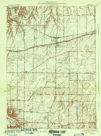
1934 Map of Webster
USGS Topo · Published 1934About this map
Webster and the surrounding townships of Monroe County are depicted here in the early 1930s, showing a landscape defined by its agricultural foundations and expanding transportation network. The New York Central Railroad cuts a straight path through the northern half of the sheet, connecting Union Hill and Webster to the broader regional economy. This era reveals a densely organized rural community, where the local social structure is still anchored by numbered school districts such as School No 10 and School No 5, and small settlements like Penfield Center and Roseland.
Find a feature on this map
56 named features on this map. Tap any name to fly to it.
Don’t see what you’re looking for? This feature index may not catch every label — zoom into the map to look around manually.
Map Details
Editions of this 1934 Webster Map
3 editions found

Other maps of this area

1895 · Rochester
USGS Topo · 1:62,500

1895 · Ontario Beach
USGS Topo · 1:62,500

1898 · Rochester
USGS Topo · 1:62,500

1899 · Ontario Beach
USGS Topo · 1:62,500

1900 · Macedon
USGS Topo · 1:62,500

1912 · Rochester
USGS Topo · 1:62,500

1912 · Ontario Beach
USGS Topo · 1:62,500

1920 · Rochester
USGS Topo · 1:62,500

1931 · Mendon Ponds
USGS Topo · 1:24,000

1931 · Rochester East
USGS Topo · 1:24,000