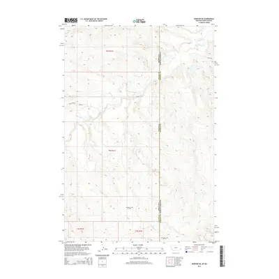
2014 Map of Webster NE
USGS Topo · Published 2014About this map
Little Beaver East Oil Field anchors the southern portion of this landscape where the high plains of eastern Montana meet the North Dakota border. The terrain is defined by a dendritic drainage pattern, most notably the winding course of Little Beaver Cr which traverses the center of the sheet. Further north, the smaller Buffalo Cr cuts through the uplands, while Big Gumbo Cr emerges in the south near the state line. This 2014 survey reveals an area primarily shaped by natural topography and energy extraction, with a sparse transportation network consisting of routes like Co Road 4 and the descriptive Hidden Water Trl. The intersection of Fallon and Bowman counties is clearly delineated along the eastern margin, marking a remote boundary in the heart of the Williston Basin region.
Find a feature on this map
13 named features on this map. Tap any name to fly to it.
Don’t see what you’re looking for? This feature index may not catch every label — zoom into the map to look around manually.
Map Details
Editions of this 2014 Webster NE Map
This is the sole edition of this map. No revisions or reprints were ever made.
Other maps of this area

1953 · Miles City
USGS Topo · 1:250,000

1953 · Dickinson
USGS Topo · 1:250,000

1957 · Dickinson
USGS Topo · 1:250,000

1957 · Miles City
USGS Topo · 1:250,000

1958 · Miles City
USGS Topo · 1:250,000

1973 · Kid Creek
USGS Topo · 1:24,000
1973 · Cedar Ridge
USGS Topo · 1:24,000

1980 · Marmarth
USGS Topo · 1:24,000

1981 · Webster NW
USGS Topo · 1:24,000

1981 · Baker
USGS Topo · 1:100,000