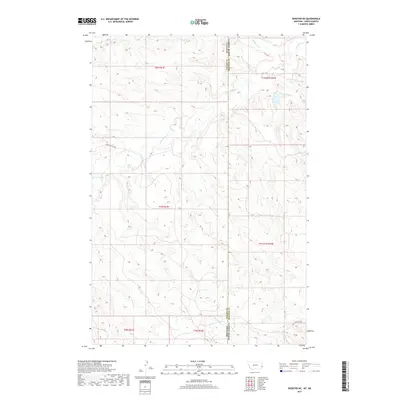
2017 Map of Webster NE
USGS Topo · Published 2017About this map
The borderlands of Montana and North Dakota meet along a high-plains landscape defined by seasonal drainages and essential ranch-to-market access roads. In this region, Little Beaver Cr meanders through the central terrain, while Buffalo Cr crosses the northeastern corner near the Fallon County and Bowman County line. The presence of Oilfield Rd in the southeastern quadrant points to the industrial activity of the Williston Basin, which has long shaped the local economy and land use. The topography is marked by remote drainage systems like Big Gumbo Cr and localized routes such as Hidden Water Trl, reflecting the sparse settlement patterns of the Northern Great Plains where water sources and infrastructure are critical for livestock and energy production.
Find a feature on this map
6 named features on this map. Tap any name to fly to it.
Don’t see what you’re looking for? This feature index may not catch every label — zoom into the map to look around manually.
Map Details
Editions of this 2017 Webster NE Map
This is the sole edition of this map. No revisions or reprints were ever made.
Other maps of this area

1953 · Miles City
USGS Topo · 1:250,000

1953 · Dickinson
USGS Topo · 1:250,000

1957 · Dickinson
USGS Topo · 1:250,000

1957 · Miles City
USGS Topo · 1:250,000

1958 · Miles City
USGS Topo · 1:250,000

1973 · Kid Creek
USGS Topo · 1:24,000
1973 · Cedar Ridge
USGS Topo · 1:24,000

1980 · Marmarth
USGS Topo · 1:24,000

1981 · Webster NW
USGS Topo · 1:24,000

1981 · Baker
USGS Topo · 1:100,000