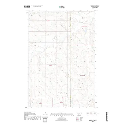
2020 Map of Webster NE
USGS Topo · Published 2020About this map
Little Beaver Cr and Buffalo Cr define the drainage patterns of this borderland where Fallon County, Montana, meets North Dakota. The landscape is marked by the transition between the Big Missouri and Little Missouri watersheds, characterized by the intricate dendritic drainage of Big Gumbo Cr in the south. This area, largely defined by the Public Land Survey System grids of Township 6 North, Range 61 East and neighboring divisions, shows a modern infrastructure influenced by energy extraction and remote access. Oilfield Road cuts across the southeastern corner, while the Hidden Water Trail provides a specialized route through the western hills. The map highlights the sparse, utilitarian nature of the High Plains border, where terrain and resource management dictate the placement of roads and trails across the state line.
Find a feature on this map
13 named features on this map. Tap any name to fly to it.
Don’t see what you’re looking for? This feature index may not catch every label — zoom into the map to look around manually.
Map Details
Editions of this 2020 Webster NE Map
This is the sole edition of this map. No revisions or reprints were ever made.
Other maps of this area

1953 · Miles City
USGS Topo · 1:250,000

1953 · Dickinson
USGS Topo · 1:250,000

1957 · Dickinson
USGS Topo · 1:250,000

1957 · Miles City
USGS Topo · 1:250,000

1958 · Miles City
USGS Topo · 1:250,000

1973 · Kid Creek
USGS Topo · 1:24,000
1973 · Cedar Ridge
USGS Topo · 1:24,000

1980 · Marmarth
USGS Topo · 1:24,000

1981 · Webster NW
USGS Topo · 1:24,000

1981 · Baker
USGS Topo · 1:100,000