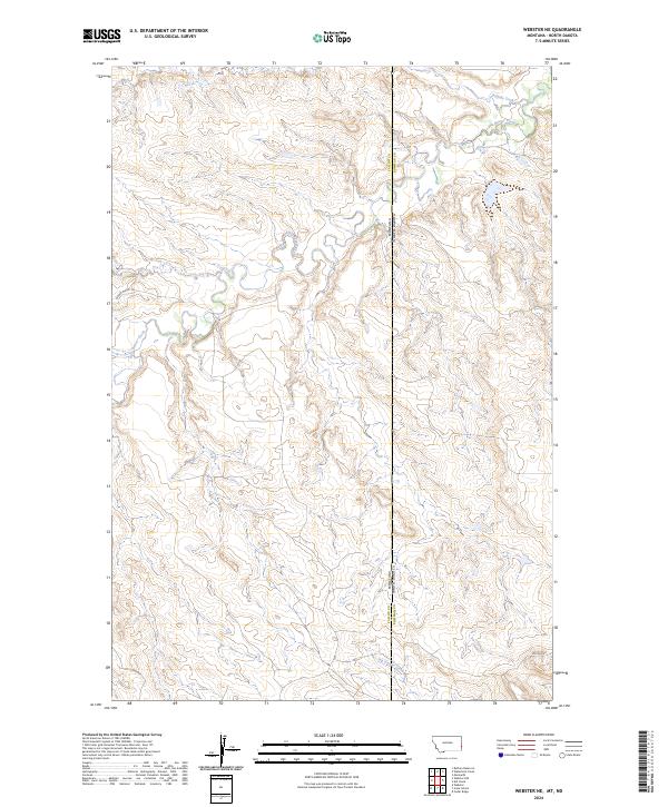
2024 Map of Webster NE
USGS Topo · Published 2024About this map
The Montana-North Dakota state line cuts through this high plains landscape, where the borders of Fallon County and Bowman County converge. The terrain is defined by the complex drainage systems of the Little Beaver Creek, which meanders across the western half of the map, and Buffalo Creek in the northeast. This modern survey illustrates a remote ranching and resource area where infrastructure is sparse, primarily consisting of the Hidden Water Trl and Oilfield Rd. The presence of the latter points to the region's industrial connection to the Bakken and Williston Basin energy developments. The map provides a detailed view of the section lines and township grids, such as t6n r61e and t132n r107w, which have dictated land ownership and usage in this cross-border region for generations.
Find a feature on this map
13 named features on this map. Tap any name to fly to it.
Don’t see what you’re looking for? This feature index may not catch every label — zoom into the map to look around manually.
Map Details
Editions of this 2024 Webster NE Map
This is the sole edition of this map. No revisions or reprints were ever made.
Other maps of this area

1953 · Miles City
USGS Topo · 1:250,000

1953 · Dickinson
USGS Topo · 1:250,000

1957 · Dickinson
USGS Topo · 1:250,000

1957 · Miles City
USGS Topo · 1:250,000

1958 · Miles City
USGS Topo · 1:250,000

1973 · Kid Creek
USGS Topo · 1:24,000
1973 · Cedar Ridge
USGS Topo · 1:24,000

1980 · Marmarth
USGS Topo · 1:24,000

1981 · Webster NW
USGS Topo · 1:24,000

1981 · Baker
USGS Topo · 1:100,000