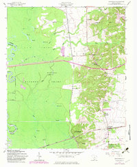
1953 Map of Wedgefield
USGS Topo · Published 1983About this map
General Sumters Tomb stands as a significant historical landmark in the elevated terrain of the High Hills of Santee, overlooking the expansive wetlands of the Wateree River basin. This 1953 survey, updated with 1982 revisions, reveals a landscape defined by the sharp transition between the upland settlements of Stateburg and the dense, waterlogged reaches of Gum Swamp and Wateree Swamp. The local economy and social structure of the mid-20th century are visible through the distribution of numerous country churches and schools, such as the Church of the Holy Cross and Hiawatha School. Transportation corridors including the Seaboard Coast Line and Southern railroads intersect at Foxville and Wedgefield, illustrating the importance of rail transit in connecting these rural Sumter County communities. To the south, the Manchester State Forest dominates the terrain, while landmarks like The Ruins hint at the area's deep-rooted plantation history.
Find a feature on this map
48 named features on this map. Tap any name to fly to it.
Don’t see what you’re looking for? This feature index may not catch every label — zoom into the map to look around manually.
Map Details
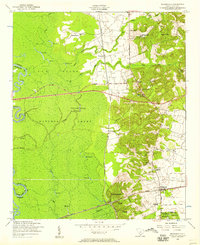
Editions of this 1953 Wedgefield Map
3 editions found
Other maps of this area

1938 · Hagood
USGS Topo · 1:62,500

1941 · Spartanburg
USGS Topo · 1:250,000

1942 · Camden
USGS Topo · 1:125,000

1943 · Eastover
USGS Topo · 1:62,500

1946 · Sumter
USGS Topo · 1:62,500

1953 · Poinsett State Park
USGS Topo · 1:24,000

1953 · Eastover
USGS Topo · 1:24,000

1953 · Wedgefield
USGS Topo · 1:24,000

1953 · Wateree
USGS Topo · 1:24,000

1953 · Rembert
USGS Topo · 1:24,000