
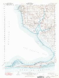
1941 Map of Weeks Bay
USGS Topo · Published 1965About this map
Weeks Bay and the surrounding coastline of Baldwin County reflect a maritime landscape defined by its complex waterways and early coastal settlements during the early 1940s. At the mouth of the Fish River, the map captures the transition from the open waters of Mobile Bay and Bon Secour Bay to the sheltered marshes of The Meadows and Gum Swamp. The shoreline is punctuated by historic landings such as Darling Ldg and Dorgans Ldg, which served as vital connections for local transport before the expansion of inland roads like Greeno Blvd.
Find a feature on this map
71 named features on this map. Tap any name to fly to it.
Don’t see what you’re looking for? This feature index may not catch every label — zoom into the map to look around manually.
Map Details
Editions of this 1941 Weeks Bay Map
2 editions found
Other maps of this area

1920 · Robertsdale
USGS Topo · 1:62,500

1921 · Bon Secour
USGS Topo · 1:62,500

1921 · Point Clear
USGS Topo · 1:62,500

1921 · Fairhope
USGS Topo · 1:62,500

1921 · Dauphin Island
USGS Topo · 1:62,500

1921 · Delchamps
USGS Topo · 1:62,500

1922 · Mobile
USGS Topo · 1:62,500

1939 · Daphne
USGS Topo · 1:31,680

1940 · Silverhill
USGS Topo · 1:31,680

1940 · Hollingers Island
USGS Topo · 1:31,680