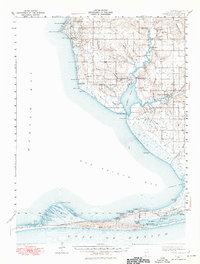
1941 Map of Weeks Bay
USGS Topo · Published 1976About this map
Battles Wharf and Point Clear anchor the eastern shoreline of Mobile Bay during this 1940s survey by F.H. Sargent, W.D. Ehrlich, and R.J. Scott. The landscape is defined by the convergence of the Fish River and Magnolia River into Weeks Bay, a region where timber and turpentine history give way to coastal settlement. Genealogists will find significant records in the numerous burial grounds, including the Confederate Rest Cem and Twin Beach Cem. Inland, the map details the rural character of communities like Barnwell, Clay City, and Marlow, connected by early routes such as Shore Boulevard and Dixie Road. To the south, the thin barrier of Sand Dunes separates the Gulf of Mexico from the Little Lagoon, showing the Intracoastal Waterway and isolated landings like Dorgans Ldg before modern development transformed the Alabama coast.
Find a feature on this map
82 named features on this map. Tap any name to fly to it.
Don’t see what you’re looking for? This feature index may not catch every label — zoom into the map to look around manually.
Map Details
Editions of this 1941 Weeks Bay Map
2 editions found

Other maps of this area

1920 · Robertsdale
USGS Topo · 1:62,500

1921 · Bon Secour
USGS Topo · 1:62,500

1921 · Point Clear
USGS Topo · 1:62,500

1921 · Fairhope
USGS Topo · 1:62,500

1921 · Dauphin Island
USGS Topo · 1:62,500

1921 · Delchamps
USGS Topo · 1:62,500

1922 · Mobile
USGS Topo · 1:62,500

1939 · Daphne
USGS Topo · 1:31,680

1940 · Silverhill
USGS Topo · 1:31,680

1940 · Hollingers Island
USGS Topo · 1:31,680