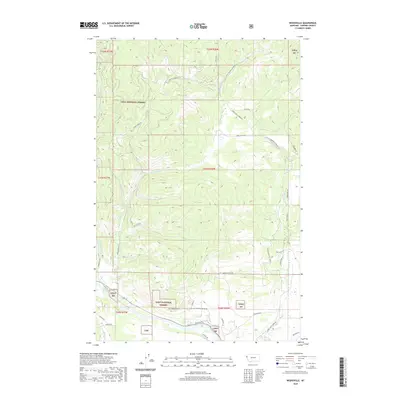
2020 Map of Weeksville
USGS Topo · Published 2020About this map
Lolo National Forest dominates the landscape of Sanders County in this modern topographic study, where the terrain is carved by a network of drainage systems including Smiley Creek and Buffalo Bill Creek. The southern corridor is defined by the Clark Fork river valley, a vital transportation and utility artery that contains the Section 6 Substation Rd and the Sec 6 Substation Rd. Local access into the timbered uplands is provided by a series of named routes like Jones Ranch Rd and The Shack Rd, reflecting the historical ranching and forestry roots of the region. The map highlights the complex interface between protected public lands and the rural valley floor, where small roads like Old Hicks Rd and Pilgeram Rd trace the early settlement patterns along the river banks.
Find a feature on this map
46 named features on this map. Tap any name to fly to it.
Don’t see what you’re looking for? This feature index may not catch every label — zoom into the map to look around manually.
Map Details
Editions of this 2020 Weeksville Map
This is the sole edition of this map. No revisions or reprints were ever made.
Other maps of this area

1918 · St Regis
USGS Topo · 1:125,000

1919 · St. Regis
USGS Topo · 1:125,000

1937 · Thompson Falls
USGS Topo · 1:125,000

1956 · St Regis
USGS Topo · 1:62,500

1956 · Wallace
USGS Topo · 1:250,000

1959 · Plains
USGS Topo · 1:62,500

1960 · Wallace
USGS Topo · 1:250,000

1964 · Calico Creek
USGS Topo · 1:24,000
1964 · Big Hole Peak
USGS Topo · 1:24,000

1964 · Coney Peak
USGS Topo · 1:24,000