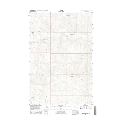
2014 Map of Weingart Place NW
USGS Topo · Published 2014About this map
The Sacagawea River winds through this section of Petroleum County, cutting across a landscape defined by deep drainages and cattle-country roads. This 2014 survey documents the remote network of trails and water sources essential to the region's ranching economy, including the Horse Camp Trl and Crooked Creek Rd. Topographic variations are marked by numerous coulees, such as Hanson Coulee and Spring Coulee, which channel seasonal runoff toward the river. In the southeastern reaches, the Drag Reservoir and its namesake Drag Cr illustrate the managed hydrology required to sustain life in this arid part of Montana. The map reflects a modern era of land management while preserving the traditional place names that have defined these range lands for generations.
Find a feature on this map
12 named features on this map. Tap any name to fly to it.
Don’t see what you’re looking for? This feature index may not catch every label — zoom into the map to look around manually.
Map Details
Editions of this 2014 Weingart Place NW Map
This is the sole edition of this map. No revisions or reprints were ever made.
Other maps of this area

1954 · Lewistown
USGS Topo · 1:250,000

1959 · Lewistown
USGS Topo · 1:250,000

1965 · Dry Coulee
USGS Topo · 1:24,000

1965 · Chain Buttes
USGS Topo · 1:24,000
1965 · Weingart Place
USGS Topo · 1:24,000

1965 · Weingart Place NW
USGS Topo · 1:24,000

1971 · Hanson Flat
USGS Topo · 1:24,000

1984 · Zortman
USGS Topo · 1:100,000
1985 · Kirkendal Flat
USGS Topo · 1:24,000

1985 · Brown Spring
USGS Topo · 1:24,000