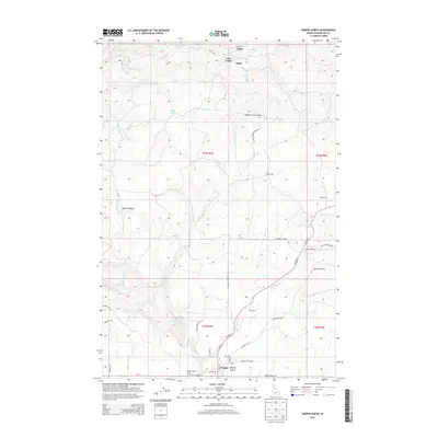
2013 Map of Weippe North
USGS Topo · Published 2013About this map
Weippe Prairie dominates the southern landscape of this Clearwater County region, where the town of Weippe serves as a hub for the surrounding timber and agricultural lands. The terrain is defined by a series of deep drainages, including Orofino Cr and Jim Ford Cr, which cut through the high plateau. Evidence of the area's industrial past and present is visible in labels for Battles Mill and McCann Mill, while smaller settlements like Omill and Haley dot the northern reaches near Cow Creek. This survey captures the transition from the open expanses of the prairie to the more dissected forest land to the north. Local history is etched into the landscape through family-named landmarks and infrastructure such as Hjalmar Johnson Rd and the Weippe Prairie Point of Interest, marking a region defined by its rugged topography and resource-based economy.
Find a feature on this map
51 named features on this map. Tap any name to fly to it.
Don’t see what you’re looking for? This feature index may not catch every label — zoom into the map to look around manually.
Map Details
Editions of this 2013 Weippe North Map
This is the sole edition of this map. No revisions or reprints were ever made.
Other maps of this area

1923 · Washington Creek
USGS Topo · 1:125,000

1924 · Kamiah
USGS Topo · 1:125,000

1924 · Weippe
USGS Topo · 1:125,000

1938 · Headquarters
USGS Topo · 1:48,000

1944 · Headquarters
USGS Topo · 1:62,500

1955 · Pullman
USGS Topo · 1:250,000

1956 · Hamilton
USGS Topo · 1:250,000

1958 · Pullman
USGS Topo · 1:250,000

1959 · Hamilton
USGS Topo · 1:250,000

1960 · Hamilton
USGS Topo · 1:250,000