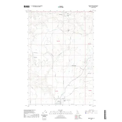
2020 Map of Weippe North
USGS Topo · Published 2020About this map
Weippe and the surrounding Weippe Prairie serve as the focal point for this Clearwater County landscape, where the plateau terrain gives way to a network of steep drainages. The map documents a region deeply tied to timber and water resources, evidenced by the presence of Johnsons Mill and the former logging siding at Omill. These small hubs are connected by a web of mountain roads, including Battles Mill Rd and Upper Fords Creek Rd, which traverse the high ground between the Orofino Cr and Jim Ford Cr watersheds.
Find a feature on this map
45 named features on this map. Tap any name to fly to it.
Don’t see what you’re looking for? This feature index may not catch every label — zoom into the map to look around manually.
Map Details
Editions of this 2020 Weippe North Map
This is the sole edition of this map. No revisions or reprints were ever made.
Other maps of this area

1923 · Washington Creek
USGS Topo · 1:125,000

1924 · Kamiah
USGS Topo · 1:125,000

1924 · Weippe
USGS Topo · 1:125,000

1938 · Headquarters
USGS Topo · 1:48,000

1944 · Headquarters
USGS Topo · 1:62,500

1955 · Pullman
USGS Topo · 1:250,000

1956 · Hamilton
USGS Topo · 1:250,000

1958 · Pullman
USGS Topo · 1:250,000

1959 · Hamilton
USGS Topo · 1:250,000

1960 · Hamilton
USGS Topo · 1:250,000