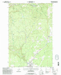
1994 Map of Weippe North
USGS Topo · Published 1997About this map
Weippe Prairie dominates the southern portion of this mid-1990s survey, illustrating a landscape defined by its timber industry and upland agriculture. The settlement of Weippe serves as the local hub, supported by a network of lumber operations including the Medley Cedar Mill, Timber Savers Mill, and the Timberline Mill. These active sites are noted alongside historical markers like Battles Mill (Site) and Johnsons Mill (Site), revealing the long-term economic reliance on the surrounding forests.
Find a feature on this map
42 named features on this map. Tap any name to fly to it.
Don’t see what you’re looking for? This feature index may not catch every label — zoom into the map to look around manually.
Map Details
Editions of this 1994 Weippe North Map
This is the sole edition of this map. No revisions or reprints were ever made.
Other maps of this area

1923 · Washington Creek
USGS Topo · 1:125,000

1924 · Kamiah
USGS Topo · 1:125,000

1924 · Weippe
USGS Topo · 1:125,000

1938 · Headquarters
USGS Topo · 1:48,000

1944 · Headquarters
USGS Topo · 1:62,500

1955 · Pullman
USGS Topo · 1:250,000

1956 · Hamilton
USGS Topo · 1:250,000

1958 · Pullman
USGS Topo · 1:250,000

1959 · Hamilton
USGS Topo · 1:250,000

1960 · Hamilton
USGS Topo · 1:250,000