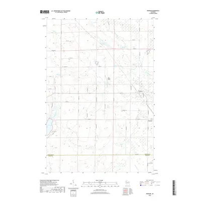
2018 Map of Weirgor
USGS Topo · Published 2018About this map
Exeland and the small settlement of Weirgor anchor the eastern edge of this landscape where Sawyer Co meets Rusk Co. The terrain is defined by a dense network of springs and creeks, including the distinctive Weirgor Springs, Buckhorn Spring, and Maple Spring, which feed into various branches of the Weirgor creek system. This area, largely comprised of wetlands and low-lying drainages, features notable elevations such as Bobcat Hill and water bodies like Deer Lake and Lost Lake. The map reveals a transition between rural homesteads and natural preservation, centered around the Kitty-Wompus Airport. Local transport is facilitated by a grid of family-named roads like Bjelland Ln and Prillaman Ln, showing the persistent agricultural and residential footprint in the northern Wisconsin woods during the early 21st century.
Find a feature on this map
55 named features on this map. Tap any name to fly to it.
Don’t see what you’re looking for? This feature index may not catch every label — zoom into the map to look around manually.
Map Details
Editions of this 2018 Weirgor Map
This is the sole edition of this map. No revisions or reprints were ever made.
Other maps of this area

1944 · Exeland
USGS Topo · 1:48,000

1944 · Couderay
USGS Topo · 1:48,000

1944 · Radisson
USGS Topo · 1:48,000

1945 · Meteor
USGS Topo · 1:48,000

1947 · Exeland
USGS Topo · 1:48,000

1948 · Couderay
USGS Topo · 1:48,000

1949 · Radisson
USGS Topo · 1:48,000

1949 · Meteor
USGS Topo · 1:48,000

1953 · Rice Lake
USGS Topo · 1:250,000

1959 · Rice Lake
USGS Topo · 1:250,000