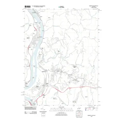
2010 Map of Weirton
USGS Topo · Published 2010About this map
Industrial and residential development along the Ohio River defines this 2010 landscape, where the steel-industry legacy is visible through extensive infrastructure like the Weirton Yards. The river serves as a primary corridor, with Browns Island and Griffen Island situated amidst a network of bridges, including the Fort Steuben Bridge and the Veterans Memorial Bridge. An unusual aviation feature, the Weirton - Steubenville Seaplane Base, highlights the specialized use of the waterway south of Pottery Addition.
Find a feature on this map
88 named features on this map. Tap any name to fly to it.
Don’t see what you’re looking for? This feature index may not catch every label — zoom into the map to look around manually.
Map Details
Editions of this 2010 Weirton Map
This is the sole edition of this map. No revisions or reprints were ever made.
Other maps of this area

1901 · Beaver
USGS Topo · 1:62,500

1904 · Wellsville
USGS Topo · 1:62,500

1904 · Steubenville
USGS Topo · 1:62,500

1904 · Beaver
USGS Topo · 1:62,500

1904 · Burgettstown
USGS Topo · 1:62,500

1906 · Burgettstown
USGS Topo · 1:62,500

1935 · Steubenville
USGS Topo · 1:62,500

1937 · Wellsville
USGS Topo · 1:62,500

1942 · Steubenville
USGS Topo · 1:62,500

1944 · Wellsville
USGS Topo · 1:62,500