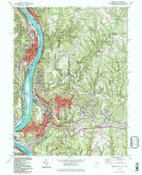
1994 Map of Weirton
USGS Topo · Published 1998About this map
The Ohio River corridor serves as the industrial and residential backbone of this tri-state border region, where West Virginia, Pennsylvania, and Ohio converge. Steel and industry dominate the riverfront, particularly near Weirton and across the water at Toronto. Industrial land use is evident in the presence of various filtration plants, substations, and a Reclaimed Strip Mine south of Weirton Heights.
Find a feature on this map
66 named features on this map. Tap any name to fly to it.
Don’t see what you’re looking for? This feature index may not catch every label — zoom into the map to look around manually.
Map Details
Editions of this 1994 Weirton Map
This is the sole edition of this map. No revisions or reprints were ever made.
Other maps of this area

1901 · Beaver
USGS Topo · 1:62,500

1904 · Wellsville
USGS Topo · 1:62,500

1904 · Steubenville
USGS Topo · 1:62,500

1904 · Beaver
USGS Topo · 1:62,500

1904 · Burgettstown
USGS Topo · 1:62,500

1906 · Burgettstown
USGS Topo · 1:62,500

1935 · Steubenville
USGS Topo · 1:62,500

1937 · Wellsville
USGS Topo · 1:62,500

1942 · Steubenville
USGS Topo · 1:62,500

1944 · Wellsville
USGS Topo · 1:62,500