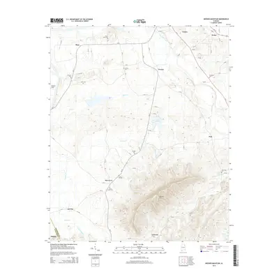
2014 Map of Weisner Mountain
USGS Topo · Published 2014About this map
Weisner Mtn anchors the southeastern landscape of this Cherokee County quadrangle, where the terrain drops sharply toward the valley of Terrapin Creek. The settlement pattern in this area is defined by a network of rural roads connecting small communities such as Pine Grove, Gnatville, and Pope. For genealogists, the map is remarkably detailed, identifying numerous burial sites including Sardis Hill Cem and Parker Grove Cem. The northern boundary includes the southern edge of Centre, the county seat, while the western portion is shaped by the winding course of Ballplay Cr near Ball Flat. The prevalence of small family and community cemeteries, like Morrison Cem and Weaver Cem, reflects a deep-rooted rural heritage that persisted well into the 21st century.
Find a feature on this map
69 named features on this map. Tap any name to fly to it.
Don’t see what you’re looking for? This feature index may not catch every label — zoom into the map to look around manually.
Map Details
Editions of this 2014 Weisner Mountain Map
This is the sole edition of this map. No revisions or reprints were ever made.
Other maps of this area

1893 · Fort Payne
USGS Topo · 1:125,000

1898 · Fort Payne
USGS Topo · 1:125,000

1900 · Fort Payne
USGS Topo · 1:125,000

1900 · Anniston
USGS Topo · 1:125,000

1947 · Colvin Gap
USGS Topo · 1:24,000

1947 · Jacksonville
USGS Topo · 1:62,500

1953 · Atlanta
USGS Topo · 1:250,000

1955 · Rome
USGS Topo · 1:250,000

1957 · Atlanta
USGS Topo · 1:250,000
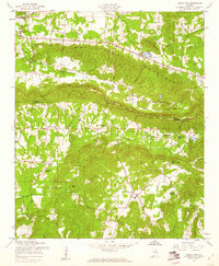
1957 · Colvin Gap
USGS Topo · 1:24,000