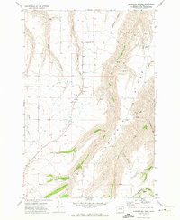
1971 Map of Weissenfels Ridge
USGS Topo · Published 1973About this map
Weissenfels Ridge dominates the landscape of southeastern Washington in this early 1970s survey, illustrating a region defined by its deep drainages and agricultural upland operations. The presence of Theon Cem and the Ausman Ranch highlights the family-driven history of the area, where rural life centered on the seasonal rhythms of the creeks and the processing of grain. Infrastructure for the local wheat economy is clearly marked through Grain Elevators, Storage Bins, and various Borrow Pit sites. The terrain is deeply incised by watercourses such as Tenmile Creek, Couse Creek, and Mill Creek, creating a complex network of gulches and draws. This document captures the intersection of natural topography and the engineered landscape of ranching and transport before modern consolidation changed the rural character of Asotin County.
Find a feature on this map
22 named features on this map. Tap any name to fly to it.
Don’t see what you’re looking for? This feature index may not catch every label — zoom into the map to look around manually.
Map Details
Editions of this 1971 Weissenfels Ridge Map
This is the sole edition of this map. No revisions or reprints were ever made.
Other maps of this area

1944 · Anatone
USGS Topo · 1:62,500

1945 · Clarkston
USGS Topo · 1:62,500

1946 · Limekiln Rapids
USGS Topo · 1:62,500

1946 · Anatone
USGS Topo · 1:62,500

1948 · Clarkston
USGS Topo · 1:62,500

1955 · Pullman
USGS Topo · 1:250,000

1958 · Pullman
USGS Topo · 1:250,000

1958 · Lewiston Orchards South
USGS Topo · 1:24,000

1958 · Lewiston Orchards
USGS Topo · 1:62,500
1968 · Captain John Rapids
USGS Topo · 1:24,000