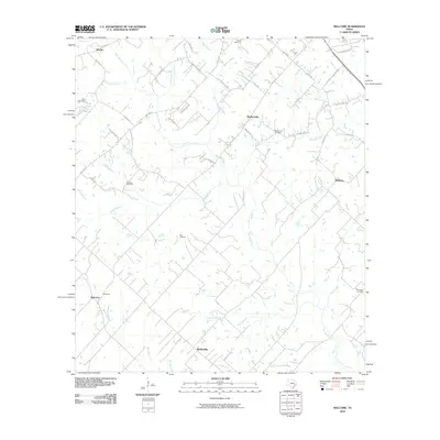
2010 Map of Welcome
USGS Topo · Published 2010About this map
Welcome and Bleiblerville anchor this rural landscape in Austin and Washington Counties, where a network of family-named roads and small cemeteries traces the region's agricultural history. Local lineages are preserved through landmarks like the Salem Cemetery, Meir Cemetery, and Germania Cemetery, while the presence of the Brenham Oil Field highlights the area's energy production. The terrain is deeply carved by a dense drainage system, including East Mill Creek and Rocky Creek, which flow toward the Brazos River basin.
Find a feature on this map
55 named features on this map. Tap any name to fly to it.
Don’t see what you’re looking for? This feature index may not catch every label — zoom into the map to look around manually.
Map Details
Editions of this 2010 Welcome Map
This is the sole edition of this map. No revisions or reprints were ever made.
Other maps of this area

1919 · Fayettsville
USGS Topo · 1:62,500

1930 · Brenham
USGS Topo · 1:62,500

1953 · Seguin
USGS Topo · 1:250,000

1954 · Austin
USGS Topo · 1:250,000

1956 · Bellville
USGS Topo · 1:62,500

1956 · Brenham
USGS Topo · 1:62,500

1958 · Seguin
USGS Topo · 1:250,000

1958 · Industry
USGS Topo · 1:24,000

1958 · Greenvine
USGS Topo · 1:24,000

1958 · Burton
USGS Topo · 1:24,000