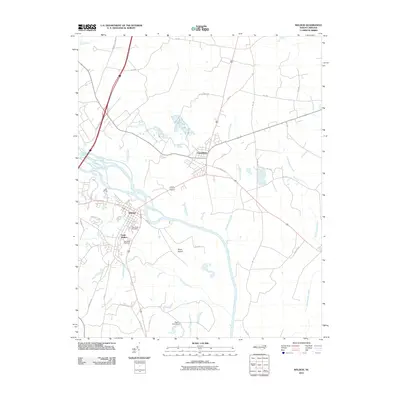
2010 Map of Weldon
USGS Topo · Published 2010About this map
The Roanoke River dominates this portion of Halifax and Northampton Counties, serving as the historical and geographic centerpiece for the riverfront towns of Weldon and South Weldon. This 2010 survey illustrates the developed corridor south of the river, where local genealogists can locate Cedarwood Cemetery and Oak Ridge Cemetery near the heart of the settlement. North of the river, Garysburg sits at a critical junction of regional routes and rail lines, surrounded by a complex network of tributaries such as Trouble Field Creek and Arthurs Creek. The landscape transitions from the residential and commercial streets of Weldon to the low-lying terrain of Mush Island and the braided channels of Mush Island Gut, revealing the influence of the river's hydrology on local land use and infrastructure, including the Pearce Pond Dam.
Find a feature on this map
38 named features on this map. Tap any name to fly to it.
Don’t see what you’re looking for? This feature index may not catch every label — zoom into the map to look around manually.
Map Details
Editions of this 2010 Weldon Map
This is the sole edition of this map. No revisions or reprints were ever made.
Other maps of this area

1919 · Emporia
USGS Topo · 1:62,500

1919 · Arringdale
USGS Topo · 1:48,000

1920 · Arringdale
USGS Topo · 1:62,500

1942 · Arringdale
USGS Topo · 1:62,500

1942 · Emporia
USGS Topo · 1:62,500

1953 · Norfolk
USGS Topo · 1:250,000

1963 · Skippers
USGS Topo · 1:24,000

1963 · Barley
USGS Topo · 1:24,000
1966 · Claresville
USGS Topo · 1:24,000

1974 · Halifax
USGS Topo · 1:24,000