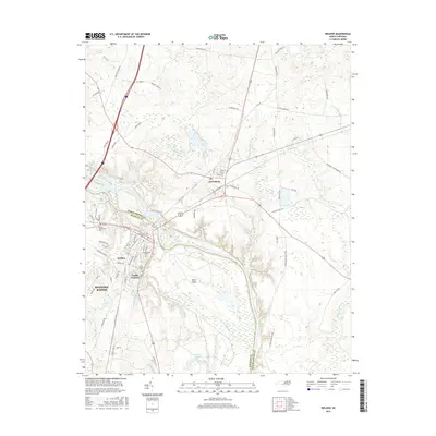
2016 Map of Weldon
USGS Topo · Published 2016About this map
The Roanoke River carves a winding path through the center of this landscape, separating Northampton Co from Halifax Co and defining the development of several riverfront communities. On the southern banks, the town of Weldon and adjacent South Weldon serve as focal points for local history, featuring established sites such as Cedarwood Cem and Oak Ridge Cem. Across the water to the north lies Garysburg, situated near the confluence of major transit routes and the river’s expansive wetlands.
Find a feature on this map
77 named features on this map. Tap any name to fly to it.
Don’t see what you’re looking for? This feature index may not catch every label — zoom into the map to look around manually.
Map Details
Editions of this 2016 Weldon Map
This is the sole edition of this map. No revisions or reprints were ever made.
Other maps of this area

1919 · Emporia
USGS Topo · 1:62,500

1919 · Arringdale
USGS Topo · 1:48,000

1920 · Arringdale
USGS Topo · 1:62,500

1942 · Arringdale
USGS Topo · 1:62,500

1942 · Emporia
USGS Topo · 1:62,500

1953 · Norfolk
USGS Topo · 1:250,000

1963 · Skippers
USGS Topo · 1:24,000

1963 · Barley
USGS Topo · 1:24,000
1966 · Claresville
USGS Topo · 1:24,000

1974 · Halifax
USGS Topo · 1:24,000