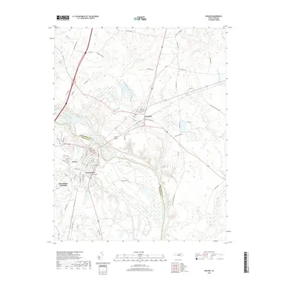
2019 Map of Weldon
USGS Topo · Published 2019About this map
The Roanoke River serves as the primary boundary and central corridor of this area, separating Northampton Co from Halifax Co. This region is defined by its strategic position at the river's fall line, where the industrial presence of Roanoke Rapids meets the established settlements of Weldon and Garysburg. The river itself is punctuated by complex hydrologic features such as Mush Island and the meandering channels of Mush Island Gl and Mush Island Sl.
Find a feature on this map
78 named features on this map. Tap any name to fly to it.
Don’t see what you’re looking for? This feature index may not catch every label — zoom into the map to look around manually.
Map Details
Editions of this 2019 Weldon Map
This is the sole edition of this map. No revisions or reprints were ever made.
Other maps of this area

1919 · Emporia
USGS Topo · 1:62,500

1919 · Arringdale
USGS Topo · 1:48,000

1920 · Arringdale
USGS Topo · 1:62,500

1942 · Arringdale
USGS Topo · 1:62,500

1942 · Emporia
USGS Topo · 1:62,500

1953 · Norfolk
USGS Topo · 1:250,000

1963 · Skippers
USGS Topo · 1:24,000

1963 · Barley
USGS Topo · 1:24,000
1966 · Claresville
USGS Topo · 1:24,000

1974 · Halifax
USGS Topo · 1:24,000