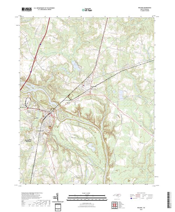
2022 Map of Weldon
USGS Topo · Published 2022About this map
The Roanoke River carves a winding path through this landscape, serving as the primary boundary between Northampton and Halifax counties. This riverine environment is defined by complex hydrology, featuring the expansive Mush Island and secondary waterways like Chockoyotte Cr and Trouble Field Cr. The settlement pattern centers on the town of Weldon and South Weldon, which developed along the riverbanks, and Garysburg to the northeast.
Find a feature on this map
77 named features on this map. Tap any name to fly to it.
Don’t see what you’re looking for? This feature index may not catch every label — zoom into the map to look around manually.
Map Details
Editions of this 2022 Weldon Map
This is the sole edition of this map. No revisions or reprints were ever made.
Other maps of this area

1919 · Emporia
USGS Topo · 1:62,500

1919 · Arringdale
USGS Topo · 1:48,000

1920 · Arringdale
USGS Topo · 1:62,500

1942 · Arringdale
USGS Topo · 1:62,500

1942 · Emporia
USGS Topo · 1:62,500

1953 · Norfolk
USGS Topo · 1:250,000

1963 · Skippers
USGS Topo · 1:24,000

1963 · Barley
USGS Topo · 1:24,000
1966 · Claresville
USGS Topo · 1:24,000

1974 · Halifax
USGS Topo · 1:24,000