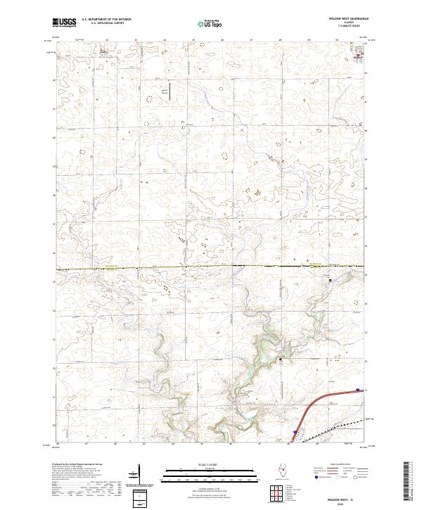
2024 Map of Weldon West
USGS Topo · Published 2024About this map
Weldon and Lane anchor this central Illinois landscape, where the flat agricultural plains of De Witt Co meet the winding corridor of Friends Creek. The terrain is defined by a dense grid of rural corridors such as Ospur RD and White Pigeon RD, reflecting the highly organized section-line development characteristic of the region's farming history. Along the southern boundary, the land transitions into Macon Co, marked by the meandering path of Friends Creek Ditch and the forested riparian zones that contrast with the surrounding fields.
Find a feature on this map
38 named features on this map. Tap any name to fly to it.
Don’t see what you’re looking for? This feature index may not catch every label — zoom into the map to look around manually.
Map Details
Editions of this 2024 Weldon West Map
This is the sole edition of this map. No revisions or reprints were ever made.
Other maps of this area

1929 · Decatur
USGS Topo · 1:62,500

1933 · Decatur
USGS Topo · 1:62,500

1937 · Monticello
USGS Topo · 1:48,000

1943 · Monticello
USGS Topo · 1:62,500

1955 · Bement
USGS Topo · 1:62,500

1957 · Maroa
USGS Topo · 1:62,500

1958 · Peoria
USGS Topo · 1:250,000

1958 · Decatur
USGS Topo · 1:250,000

1961 · Peoria
USGS Topo · 1:250,000

1961 · Decatur
USGS Topo · 1:250,000