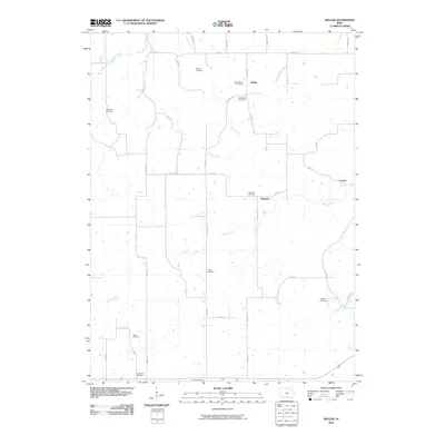
2010 Map of Weller
USGS Topo · Published 2010About this map
The rural landscapes of Monroe County are defined by a network of small settlements and family burial grounds along the winding tributaries of the Des Moines River valley. Small hamlets like Weller, Bucknell, and Consol serve as the primary focal points within a grid of county roads, including 130th St and 550th Ave. The terrain is deeply etched by a system of waterways, notably North Cedar Creek, Sage Creek, and Whites Creek, which have dictated the placement of homesteads and local infrastructure for generations.
Find a feature on this map
42 named features on this map. Tap any name to fly to it.
Don’t see what you’re looking for? This feature index may not catch every label — zoom into the map to look around manually.
Map Details
Editions of this 2010 Weller Map
This is the sole edition of this map. No revisions or reprints were ever made.
Other maps of this area

1924 · Melcher
USGS Topo · 1:62,500

1929 · Albia
USGS Topo · 1:62,500

1935 · Russell
USGS Topo · 1:62,500

1938 · Russell
USGS Topo · 1:62,500

1939 · Mystic
USGS Topo · 1:62,500

1942 · Mystic
USGS Topo · 1:62,500

1954 · Centerville
USGS Topo · 1:250,000

1954 · Des Moines
USGS Topo · 1:250,000

1956 · Des Moines
USGS Topo · 1:250,000

1957 · Des Moines
USGS Topo · 1:250,000